
| Climate Change Animated Maps | 03 June 08 |
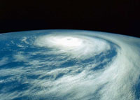 Google Earth images from NASA satellites are being used to illustrate potential impacts of climate change. Google's interactive and animated maps are a time-lapse series of global warming scenarios over the new century. Google Earth images from NASA satellites are being used to illustrate potential impacts of climate change. Google's interactive and animated maps are a time-lapse series of global warming scenarios over the new century.Google launched the "Climate Change in Our World" project in cooperation with Britain's environmental ministry to produce maps intended to raise awareness about effects of climate change. Animations of temperature changes were created under medium scenario greenhouse gas emissions projections. Maps show changes at a planetary perspective with the ability to zoom in on countries and cities. Users can view loss of Antarctic ice shelves since the 1950s and increased polar temperatures; access information about changing weather patterns, and learn about actions already taken in local areas. Scientists indicate global average temperatures will rise between 1.8 and 4.0 degrees Celsius this century due to carbon emissions from burning fossil fuels for power and transport. View Google Earth Outreach KML: Climate in Our World View May 19, 2008 UK Met Office press release View May 21, 2008 PlanetArk article View May 19, 2008 The Environmental Leader article View May 20, 2008 Sustainable Business article Visit Project Vulcan website Sources: Google Earth, Met Office, Planet Ark, The Environmental Leader, Sustainable Business, Project Vulcan |
|
 Print version Print version |
Top |
