
Protected Areas Map Gallery
| Protected areas mapping appears throughout ManitobaWildlands.org. In this section, all protected areas maps (including Manitoba Wildlands' own mapping as well as maps from external sources) are listed by category. Click on the categories in the menu below to access the maps in each category. Click on the thumbnail image or map title to view each map full-size in a new window. |
||
| Manitoba Protected Areas Grade Manitoba Protected Areas Manitoba Areas of Special Interest (ASI) Manitoba Minerals Sector ASI's |
Manitoba Natural Regions Manitoba Protected Areas Announcements National Parks - Manitoba Provincial Parks - Manitoba |
|
Manitoba Protected Areas Grade |
||
 |
Title: Manitoba
Protected Areas Actions 2009 Grade Year Date: Winter 2010 Grade given: C (Manitoba Wildlands)  Description: These annual maps accompany each year's protected areas grade for Manitoba government action. The grade is based on Manitoba public policy and ecological standards. (PDF) |
|
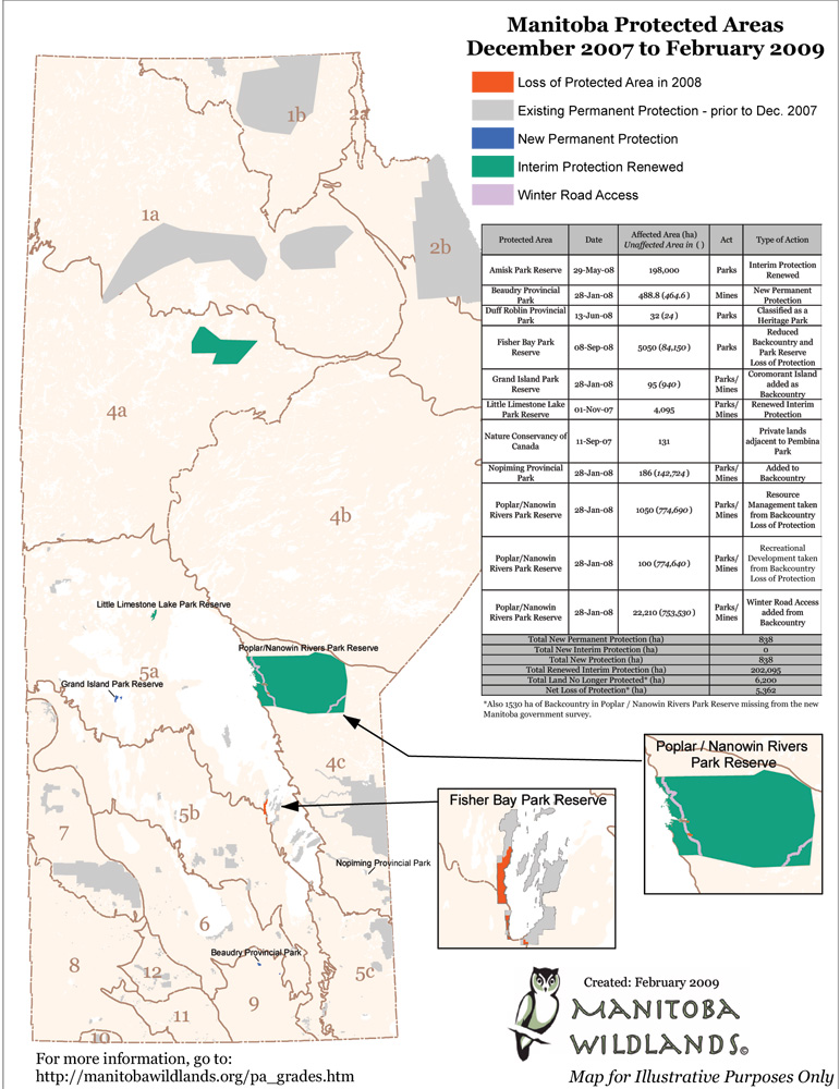 |
Title: Manitoba Protected Areas Actions 2008 Grade Year Date: Winter 2009 Grade given: F (Manitoba Wildlands) Description: These annual maps accompany each year's protected areas grade for Manitoba government action. The grade is based on Manitoba public policy and ecological standards. |
|
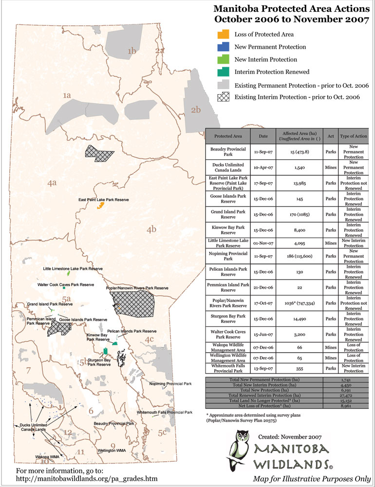 |
Title: Manitoba Protected Areas Actions 2007 Grade Year Date: Fall 2007 Grade given: C- (Manitoba Wildlands) Description: These annual maps accompany each year's protected areas grade for Manitoba government action. The grade is based on Manitoba public policy and ecological standards. |
|
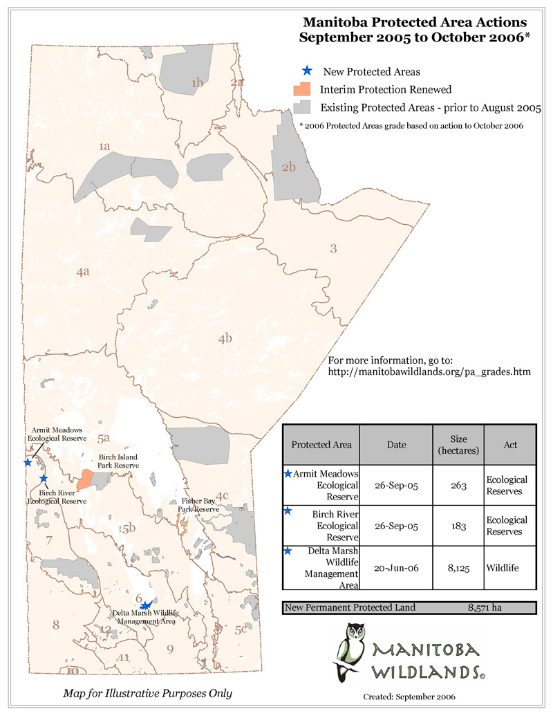 |
Title: Manitoba Protected Areas Actions 2006 Grade Year Date: Fall 2006 Grade given: D (Manitoba Wildlands) Description: These annual maps accompany each year's protected areas grade for Manitoba government action. The grade is based on Manitoba public policy and ecological standards. |
|
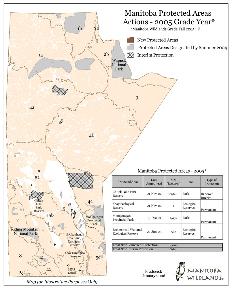 |
Title: Manitoba Protected Areas Actions 2005 Grade Year Date: Fall 2005 Grade given: F (Manitoba Wildlands) Description: These annual maps accompany each year's protected areas grade for Manitoba government action. The grade is based on Manitoba public policy and ecological standards. |
|
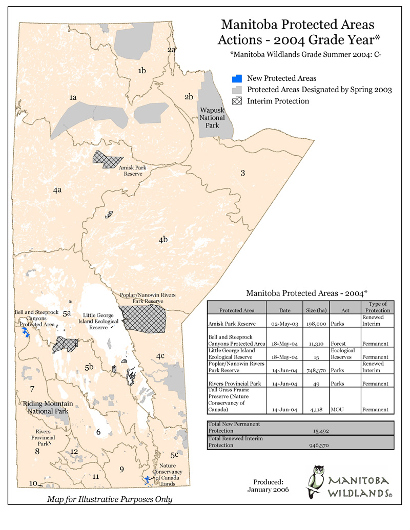 |
Title: Manitoba Protected Areas Actions 2004 Grade Year Date: Summer 2004 Grade given: C- (Manitoba Wildlands) Description: These annual maps accompany each year's protected areas grade for Manitoba government action. The grade is based on Manitoba public policy and ecological standards. |
|
 |
Title: Manitoba Protected Areas Actions 2003 Grade Year Date: Spring 2003 Grade given: D- (Canadian Nature Federation) Description: These annual maps accompany each year's protected areas grade for Manitoba government action. The grade is based on Manitoba public policy and ecological standards. |
|
 |
Title: Manitoba Protected Areas Actions 2002 Grade Year Date: Spring 2002 Grade given: D (Canadian Nature Federation) Description: These annual maps accompany each year's protected areas grade for Manitoba government action. The grade is based on Manitoba public policy and ecological standards. |
|
 |
Title: Manitoba Protected Areas Actions 2001 Grade Year Date: Spring 2001 Grade given: C- (Canadian Nature Federation) Description: These annual maps accompany each year's protected areas grade for Manitoba government action. The grade is based on Manitoba public policy and ecological standards. |
|
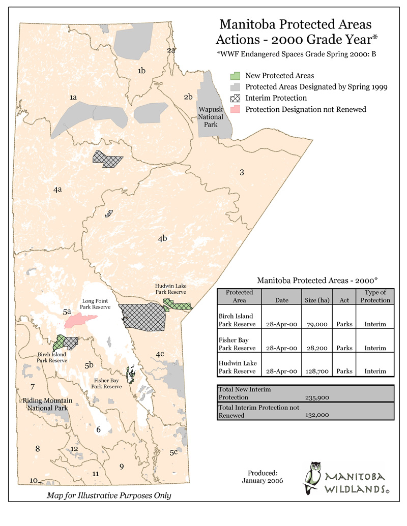 |
Title: Manitoba Protected Areas Actions 2000 Grade Year Date: Spring 2000 Grade given: B (WWF Endangered Spaces) Description: These annual maps accompany each year's protected areas grade for Manitoba government action. The grade is based on Manitoba public policy and ecological standards. |
|
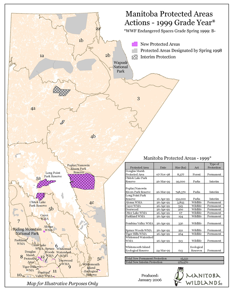 |
Title: Manitoba Protected Areas Actions 1999 Grade Year Date: Spring 1999 Grade given: B- (WWF Endangered Spaces) Description: These annual maps accompany each year's protected areas grade for Manitoba government action. The grade is based on Manitoba public policy and ecological standards. |
|
Manitoba Protected Areas |
||
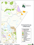 |
Title: Protected Areas in Manitoba Date: January 2014 Created by: Manitoba Government |
|
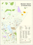 |
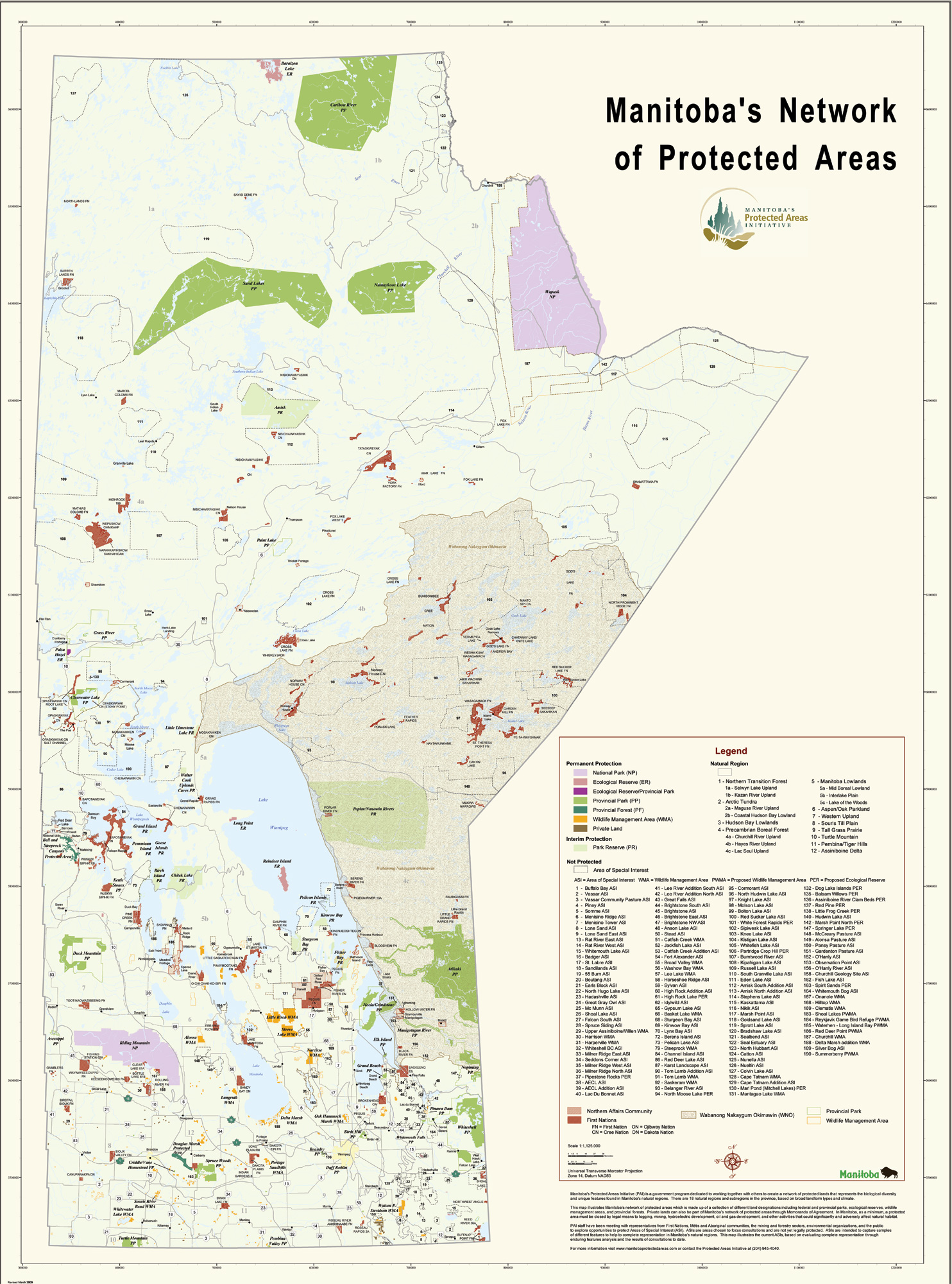
Title: Manitoba's Network of Protected Areas Date: February 2012 Created by: Manitoba Government |
|
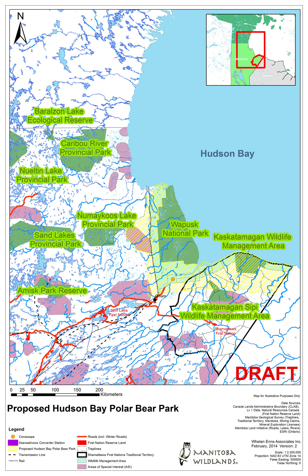 |
Title: Proposed Hudson Bay Polar Bear Park - 2014 Date: February 2014 Created by: Manitoba Wildlands |
|
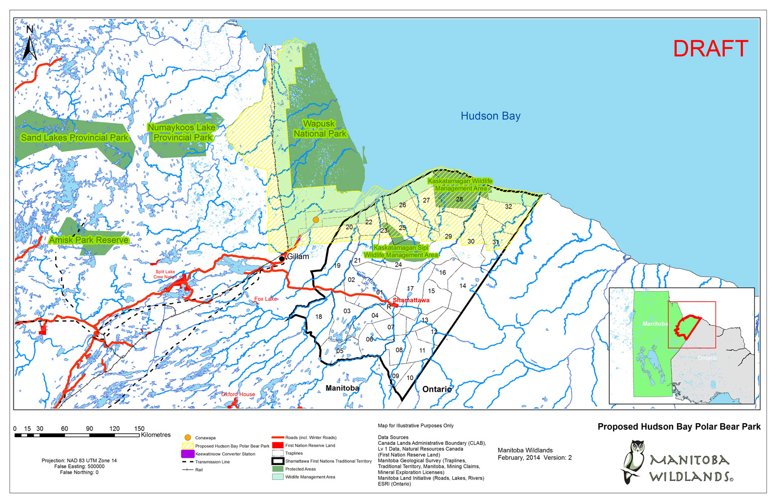 |
Title: Proposed Hudson Bay Polar Bear Park - 2014 Date: February 2014 Created by: Manitoba Wildlands |
|
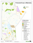 |
Title: Protected Areas Manitoba Map - 2012 Date: February 2012 Created by: Manitoba Government |
|
 |
Title: Protected Areas Manitoba Map (South) - 2011 Date: April 2011 Created by: Manitoba Wildlands |
|
 |
Title: Protected Areas Manitoba Map (North) - 2011 Date: April 2011 Created by: Manitoba Wildlands |
|
 |
Title: Protected Areas Manitoba Map - 2009 Date: March 2009 Created by: Protected Areas Initiative Description: Issued by government to show protected areas. |
|
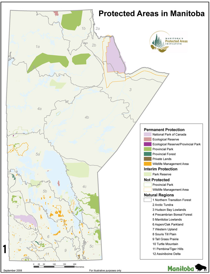 |
Title: Protected Areas Manitoba Map - 2008 Date: September 2008 Created by: Protected Areas Initiative Description: Issued by government to show protected areas. |
|
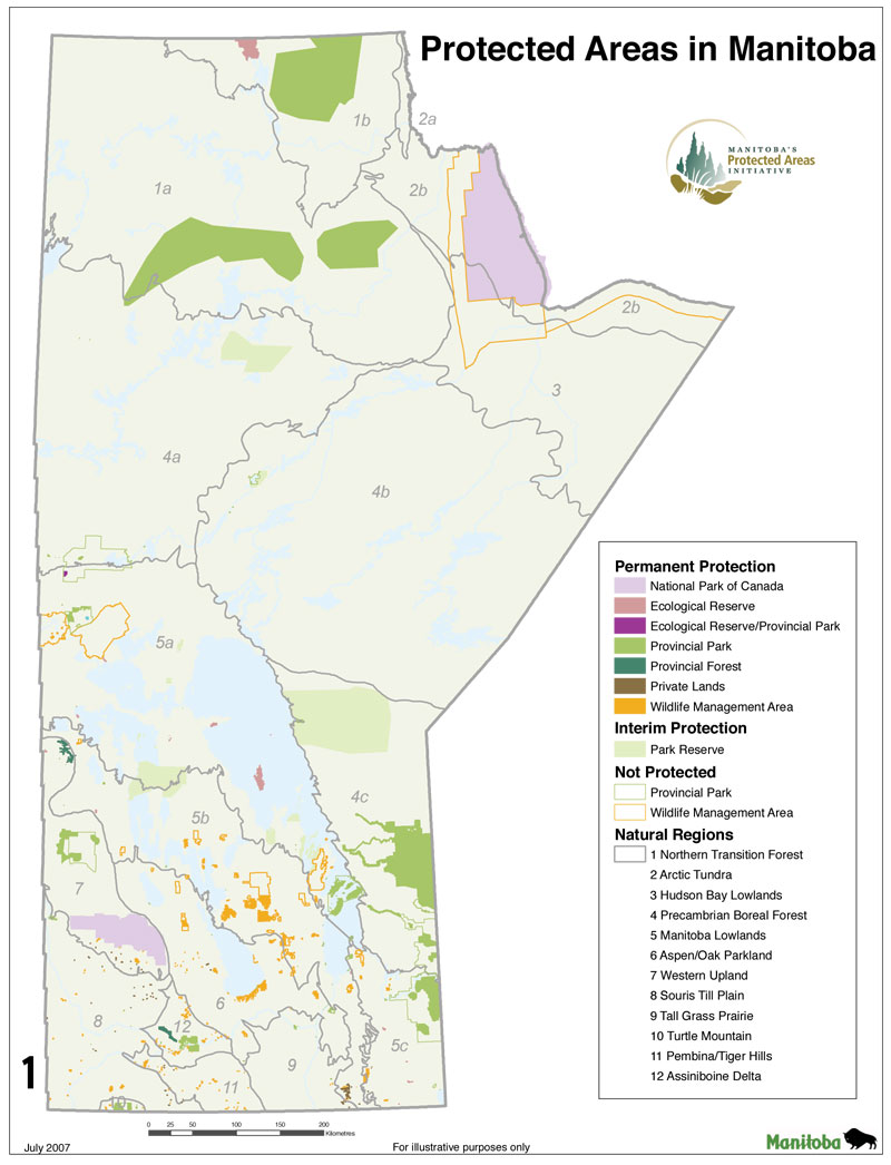 |
Title: Protected Areas Manitoba Map - 2007 Date: April 2007 Created by: Protected Areas Initiative Description: Issued by government to show protected areas. |
|
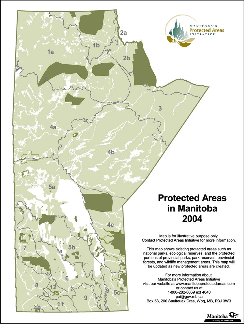 |
Title: Protected Areas Manitoba Map - 2004 Date: 2004 Created by: Protected Areas Initiative Description: Issued by government to show protected areas. |
|
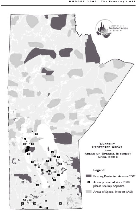 |
Title: Manitoba Current Protected Areas and Areas of Special Interest 2002 Date: April 2002 Created by: Protected Areas Initiative Description: Issued by government to show protected areas. |
|
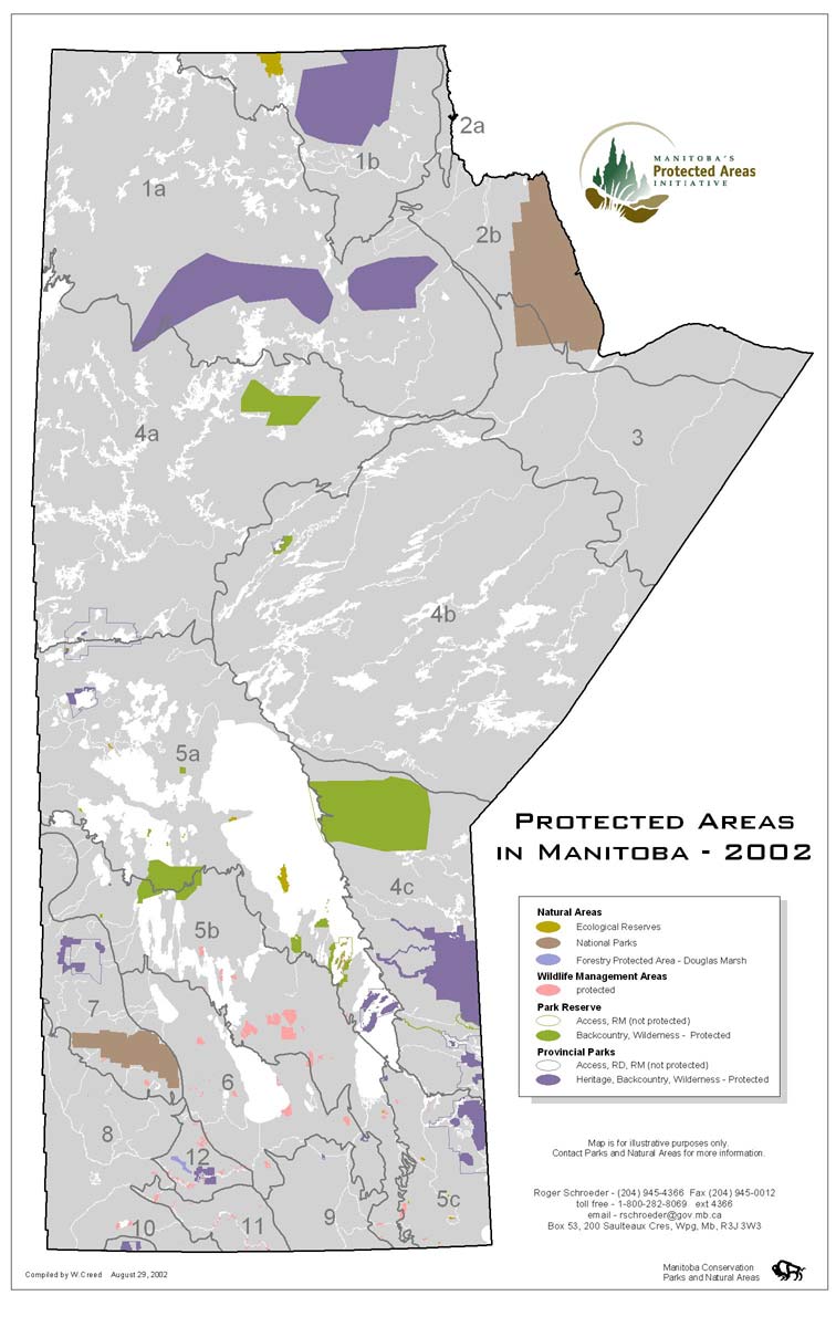 |
Title: Protected Areas Manitoba Map - 2002 Date: August 2002 Created by: Manitoba Conservation, Parks and Natural Areas Description: Issued by government to show protected areas. Download: PDF |
|
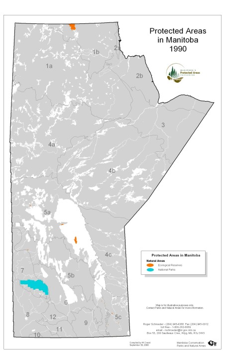 |
Title: Protected Areas Manitoba Map - 1990 Date: 2000 Created by: Manitoba Conservation, Parks and Natural Areas Description: Issued by government to show protected areas. Shows national parks and ecological reserves only. |
|
Manitoba Areas of Special Interest (ASI) |
||
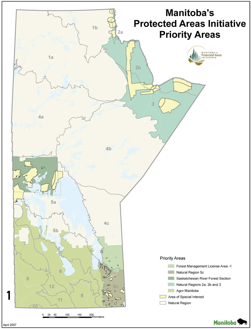 |
Title: Priority Areas of Manitoba Map 2007 Date: April 2007 Created by: Protected Areas Initiative Description: Manitoba's priority areas. |
|
 |
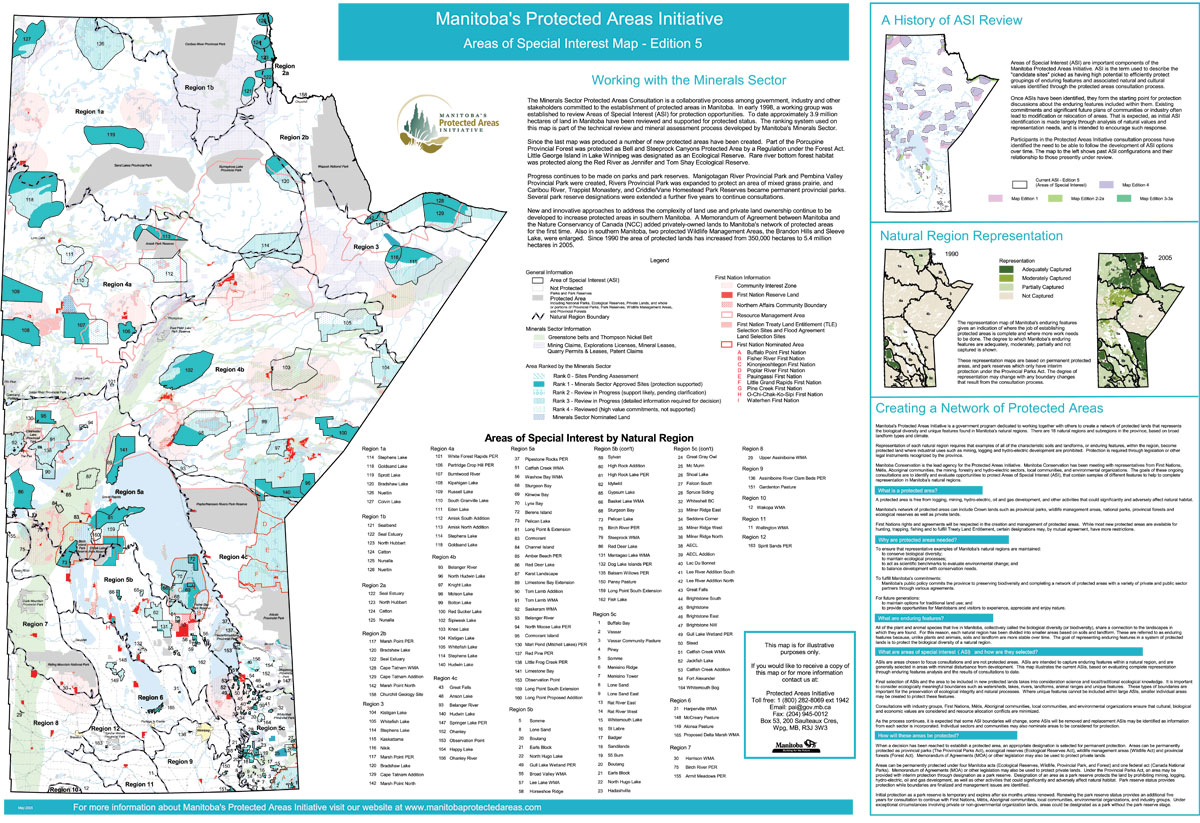
Title: Areas of Special Interest Manitoba Map 2007 Date: April 2007 Created by: Protected Areas Initiative Description: Areas of Special Interest (ASI) are designed by Manitoba Conservation, as potential protected areas. |
|
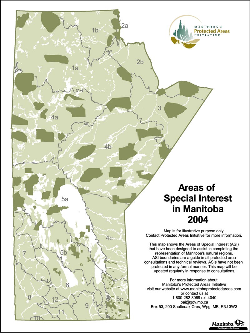 |
Title: Areas of Special Interest Manitoba Map 2004 Date: 2004 Created by: Protected Areas Initiative Description: Areas of Special Interest (ASI) are designed by Manitoba Conservation, as potential protected areas. |
|
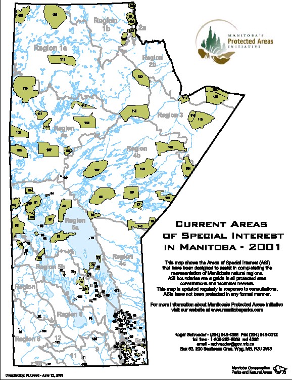 |
Title: Areas of Special Interest Manitoba Map 2001 Date: June 2001 Created by: Protected Areas Initiative Description: Areas of Special Interest (ASI) are designed by Manitoba Conservation, as potential protected areas. Download: PDF |
|
Manitoba Minerals Sector ASI's |
||
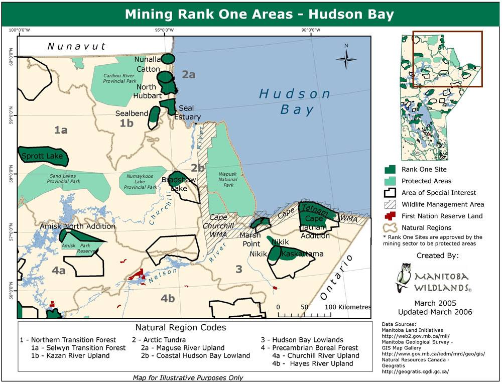 |
Title: Mining Rank One Areas - Hudson Bay 2006 Map Date: March 2006 Created by: Manitoba Wildlands Description: Rank 1 sites have been reviewed and approved by the Minerals sector for protected status. |
|
 |
Title: Natural Regions and Rank 1 2005 Detailed Map Date: May 2005 Created by: Manitoba Geological Survey Description: Rank 1 sites have been reviewed and approved by the Minerals sector for protected status. * This is the detailed version of the 2005 map. |
|
 |
Title: Natural Regions and Rank 1 2005 Map Date: November 2005 Created by: Manitoba Geological Survey Description: Rank 1 sites have been reviewed and approved by the Minerals sector for protected status. |
|
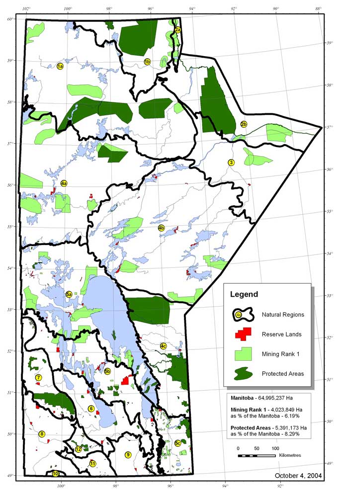 |
Title: Natural Regions and Rank 1 2004 Map Date: October 2004 Created by: Manitoba Geological Survey Description: Rank 1 sites have been reviewed and approved by the Minerals sector for protected status. |
|
 |
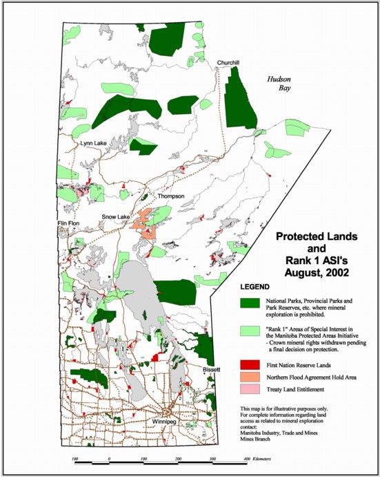
Title: Protected Lands and Rank 1 ASI's 2002 Map Date: August 2002 Created by: Protected Areas Initiative Description: Rank 1 sites have been reviewed and approved by the Minerals sector for protected status. |
|
 |
Title: Mining Sector Protected Areas Rank One 2001 Map Date: August 2002 Created by: Manitoba Industry Trade and Mines, Mines Branch Description: Rank 1 sites have been reviewed and approved by the Minerals sector for protected status. |
|
Manitoba Natural Regions |
||
 |
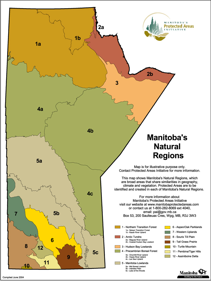
Title: Natural Regions Manitoba Map - 2007 Date: April 2007 Created by: Protected Areas Initiative |
|
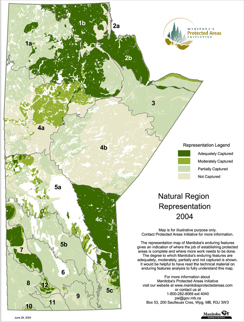 |
Title: Natural Regions Representation Manitoba Map - 2004 Date: June 2004 Created by: Protected Areas Initiative |
|
 |
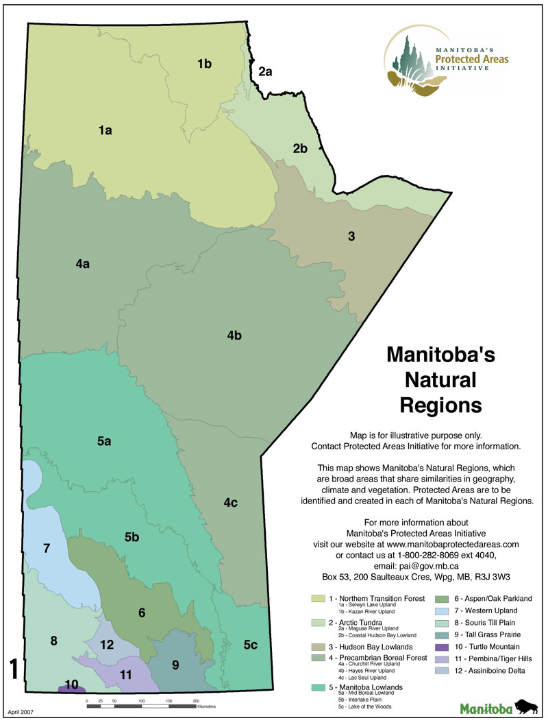
Title: Natural Regions Manitoba Map - 2004 Date: June 2004 Created by: Protected Areas Initiative |
|
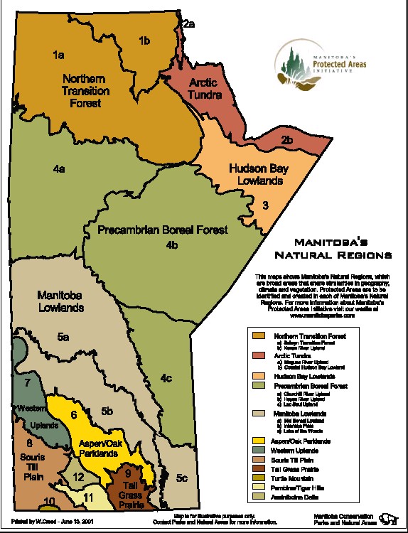 |
Title: Natural Regions Manitoba Map - 2001 Date: June 2001 Created by: Protected Areas Initiative Download: PDF |
|
Manitoba Protected Areas Announcements |
||
 |
Title: Enduring Features in Poplar/Nanowin Rivers Park Reserve Date: December 2007 Created by: Manitoba Wildlands Announcement: Protected Lands Decreased in Poplar/Nanowin Rivers Park Reserve |
|
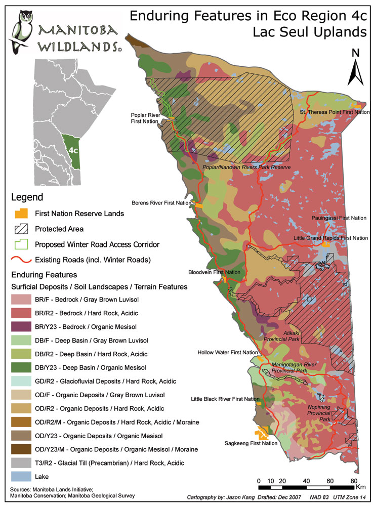 |
Title: Enduring Features in Eco Region 4c Lac Seul Uplands Date: December 2007 Created by: Manitoba Wildlands Announcement: Protected Lands Decreased in Poplar/Nanowin Rivers Park Reserve |
|
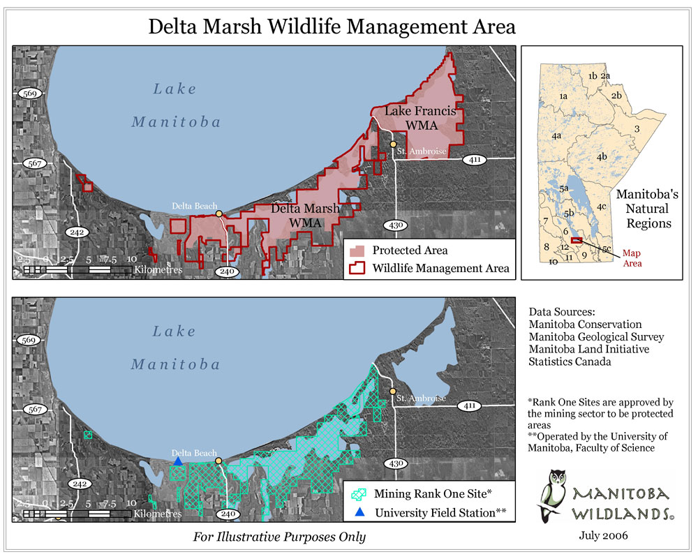 |
Title: Delta Marsh Wildlife Management Area Date: July 2006 Created by: Manitoba Wildlands Announcement: Protection of Delta Marsh, New WMAs Announced |
|
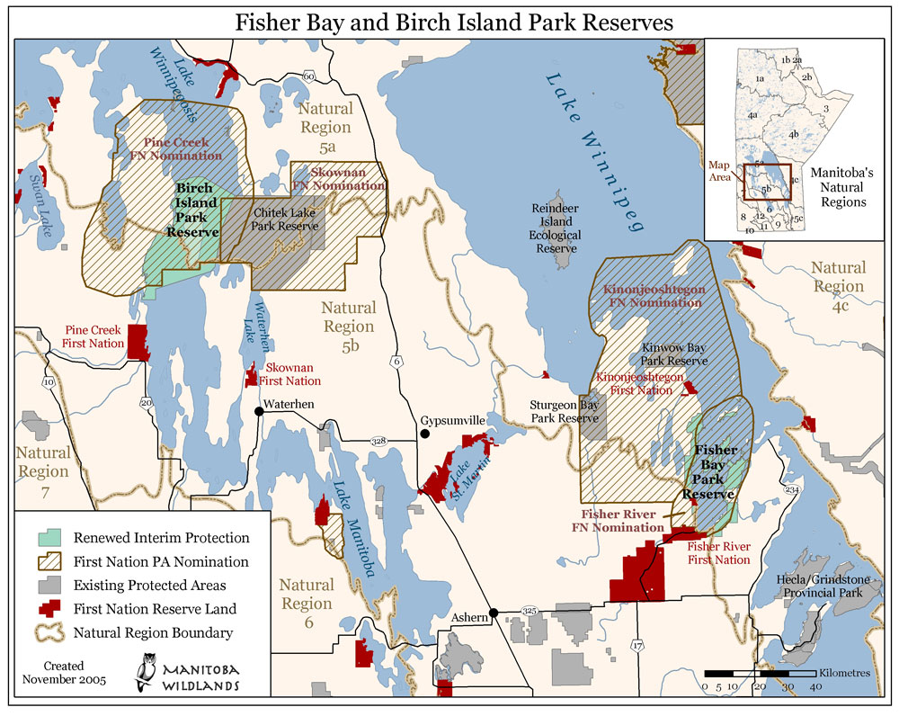 |
Title: Fisher Bay and Birch Island Park Reserves Date: November 2005 Created by: Manitoba Wildlands Announcement: Fisher Bay & Birch Island Park Reserves Renewed |
|
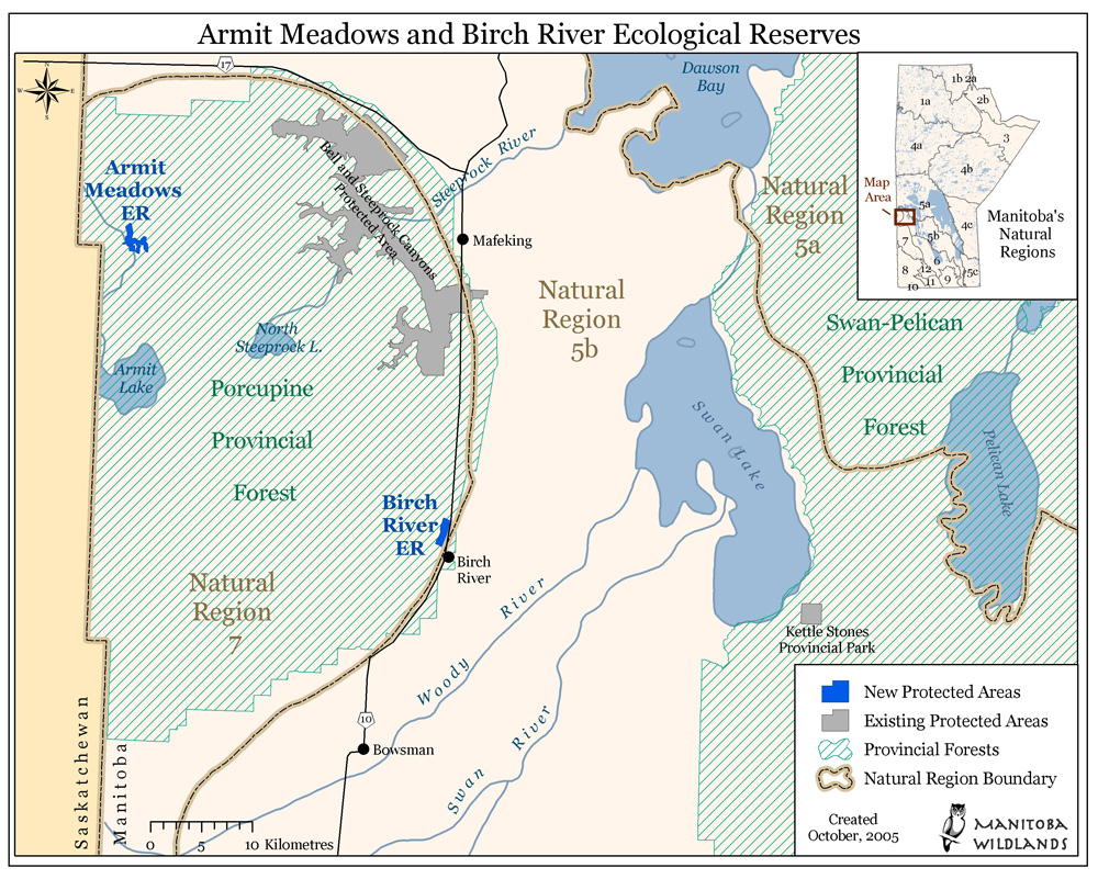 |
Title: Armit Meadows & Birch River Ecological Reserves Map Date: October 2005 Created by: Manitoba Wildlands Announcement: Porcupine Forest Reserves Announced |
|
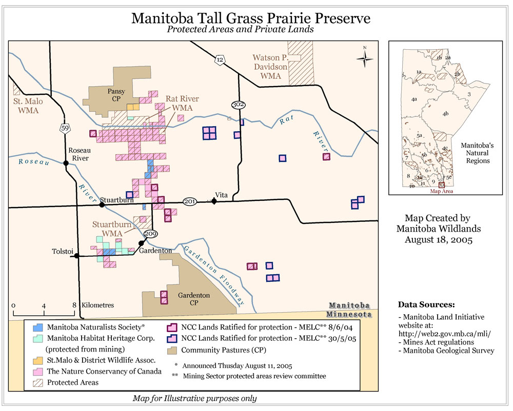 |
Title: Manitoba Tall Grass Prairie Preserve - Protected Areas and Private Lands Date: August 2005 Created by: Manitoba Wildlands Announcement: Second Tall Grass Prairie Agreement |
|
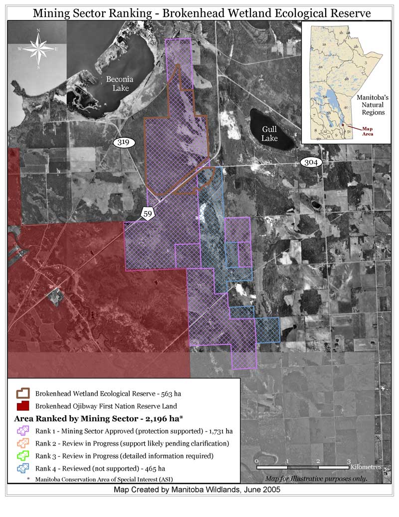 |
Title: Mining Sector Ranking - Brokenhead Wetland Ecological Reserve Date: June 2005 Created by: Manitoba Wildlands Announcement: New Brokenhead Wetland Ecological Reserve |
|
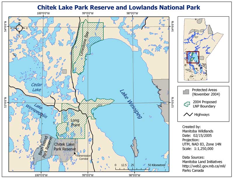 |
Title: Chitek Lake Park Reserve and Lowlands National Park Date: February 2005 Created by: Manitoba Wildlands Announcement: Chitek Lake Protection Extended |
|
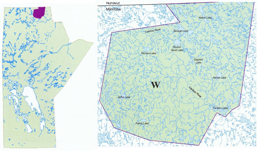 |
Title: Caribou River Provincial Park Map Date: 2002 Created by: Manitoba Conservation Announcement: Caribou River and Trappist Monastery Protected |
|
National Parks - Manitoba |
||
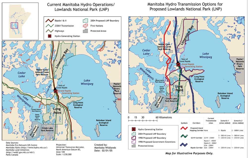 |
Title: Current Manitoba Hydro Operations/Lowlands National Park Map
& Manitoba Hydro Transmission Options for Proposed Lowlands National Park Map Date: Spring 2005 Created by: Manitoba Wildlands |
|
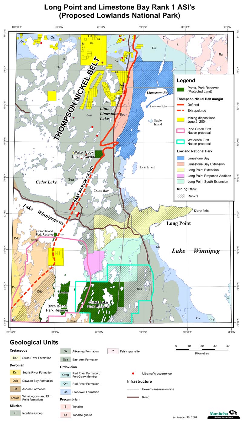 |
Title: Long Point and Limestone Bay Rank 1 ASI's (Proposed Lowlands National Park) Date: September 2004 Created by: Manitoba Geological Survey Description: Shows geology and mineral potential |
|
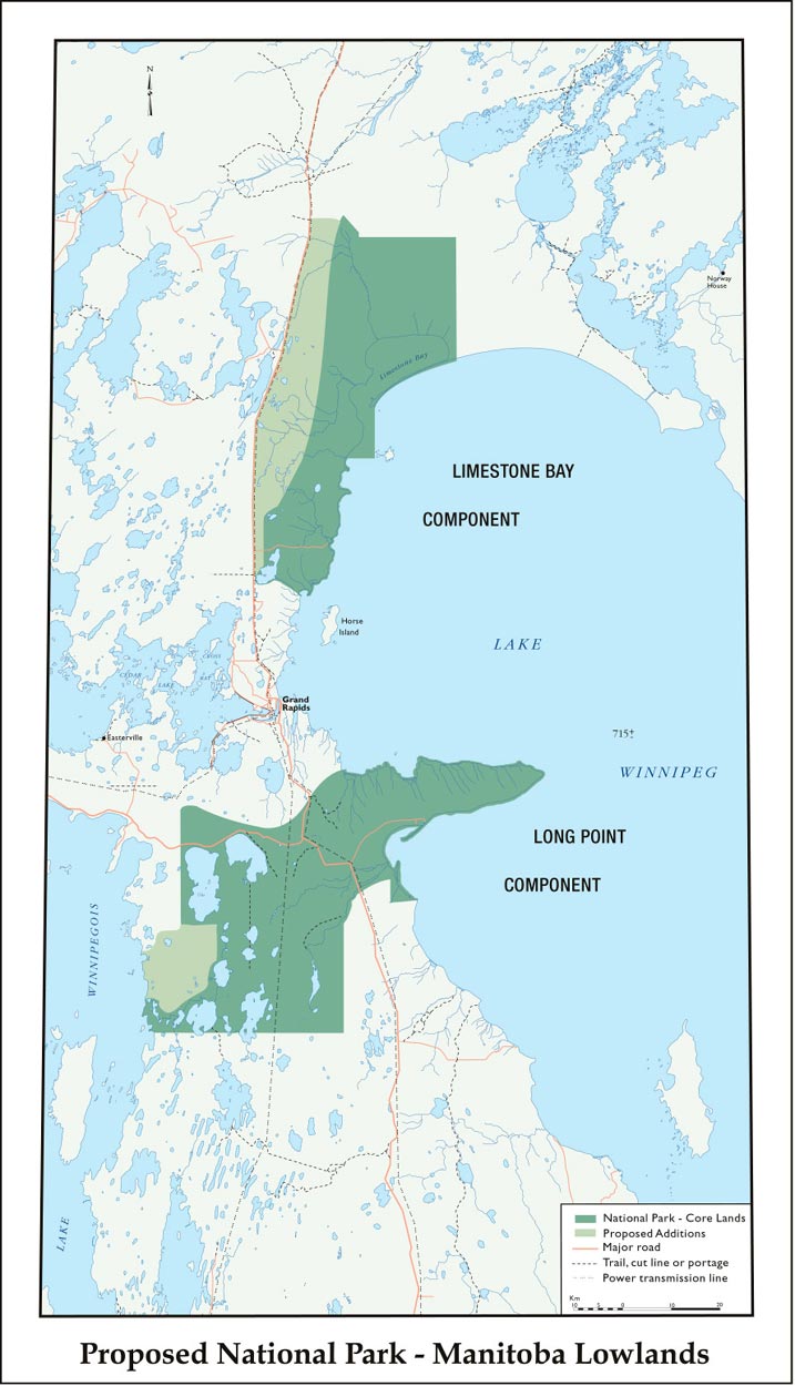 |
Title: Manitoba Lowlands National Park Proposed 2004 Map Date: 2004 Created by: Parks Canada |
|
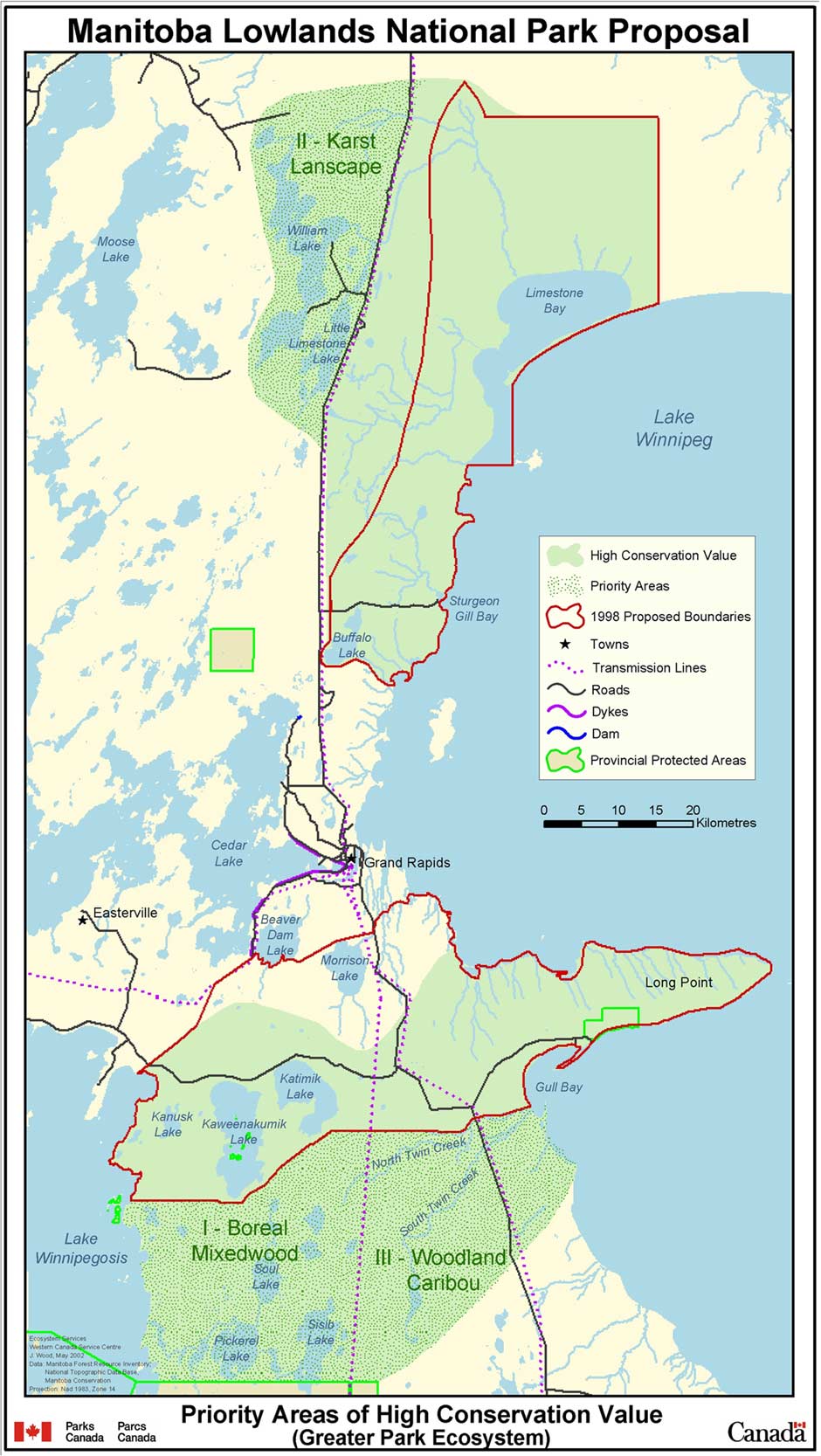 |
Title: Manitoba Lowlands National Park Proposal Map 2002 Date: May 2002 Created by: Parks Canada |
|
Provincial Parks - Manitoba |
||
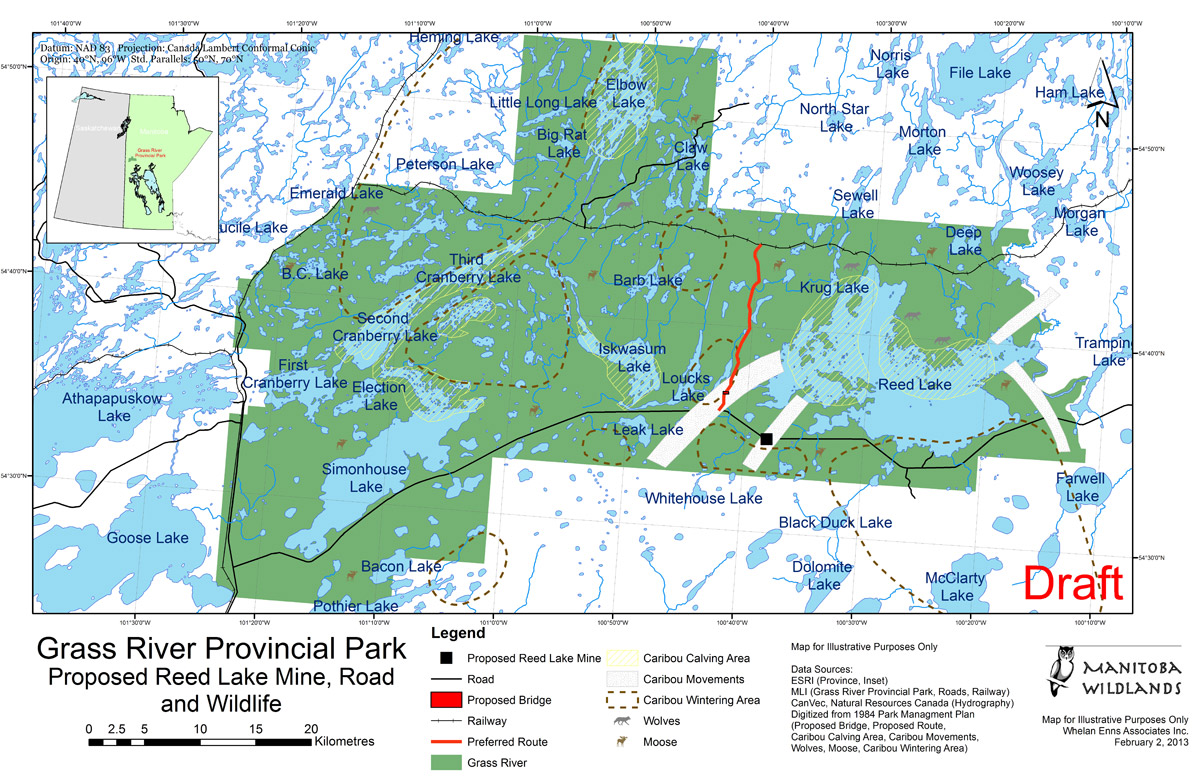 |
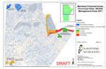
Title: Grass River Provincial Park: Proposed Reed Lake Mine, Road and Wildlife Date: February 2013 Created by: Manitoba Wildlands |
|
 |
Title: Grass River Provincial Park: Proposed Road, Wildlife and Protected Areas Date: January 2012 Created by: Manitoba Wildlands |
|
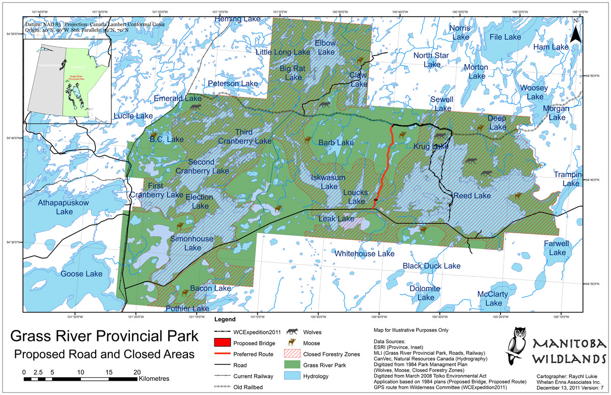 |
Title: Grass River Provincial Park: Proposed Road and Closed Areas Date: December 2011 Created by: Manitoba Wildlands |
|
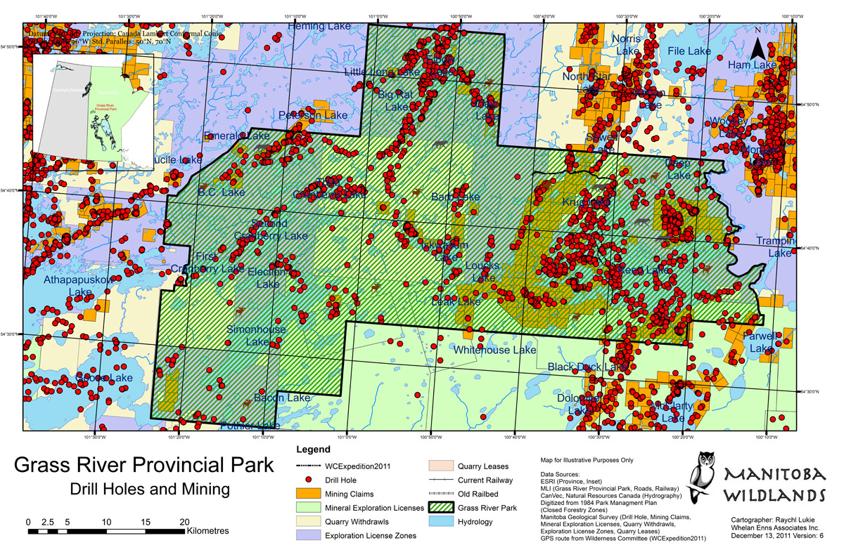 |
Title: Grass River Provincial Park: Drill Holes and Mining Date: December 2011 Created by: Manitoba Wildlands |
|
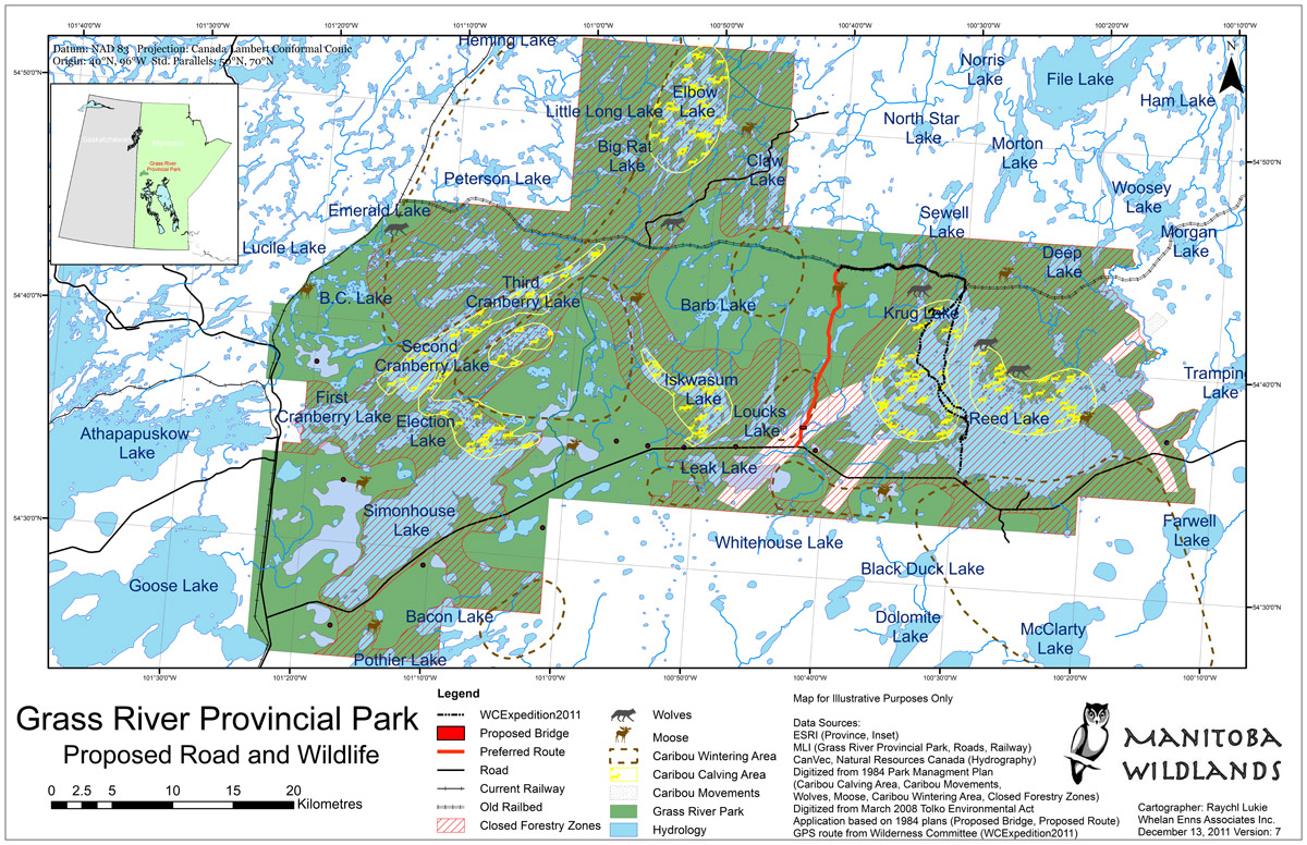 |
Title: Grass River Provincial Park: Proposed Road and Wildlife Date: December 2011 Created by: Manitoba Wildlands |
|
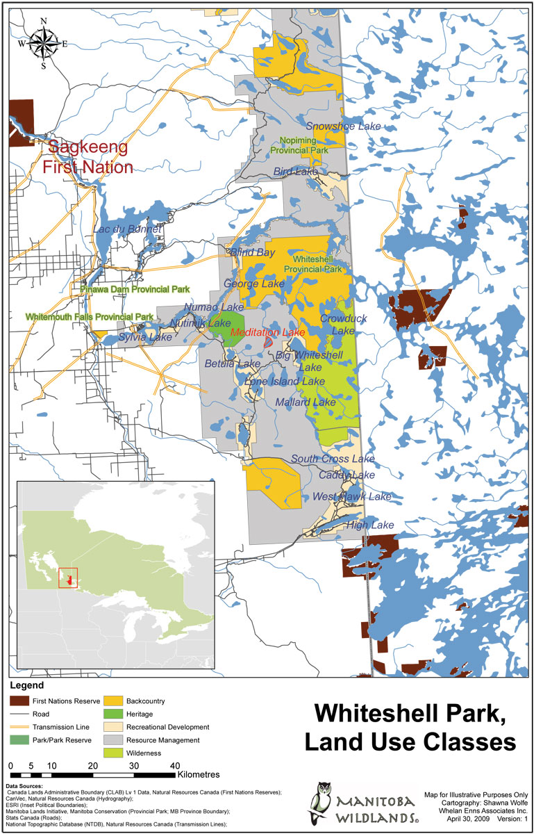 |
Title: Whiteshell Park, Land Use Classes Map Date: April 2009 Created by: Manitoba Wildlands |
|
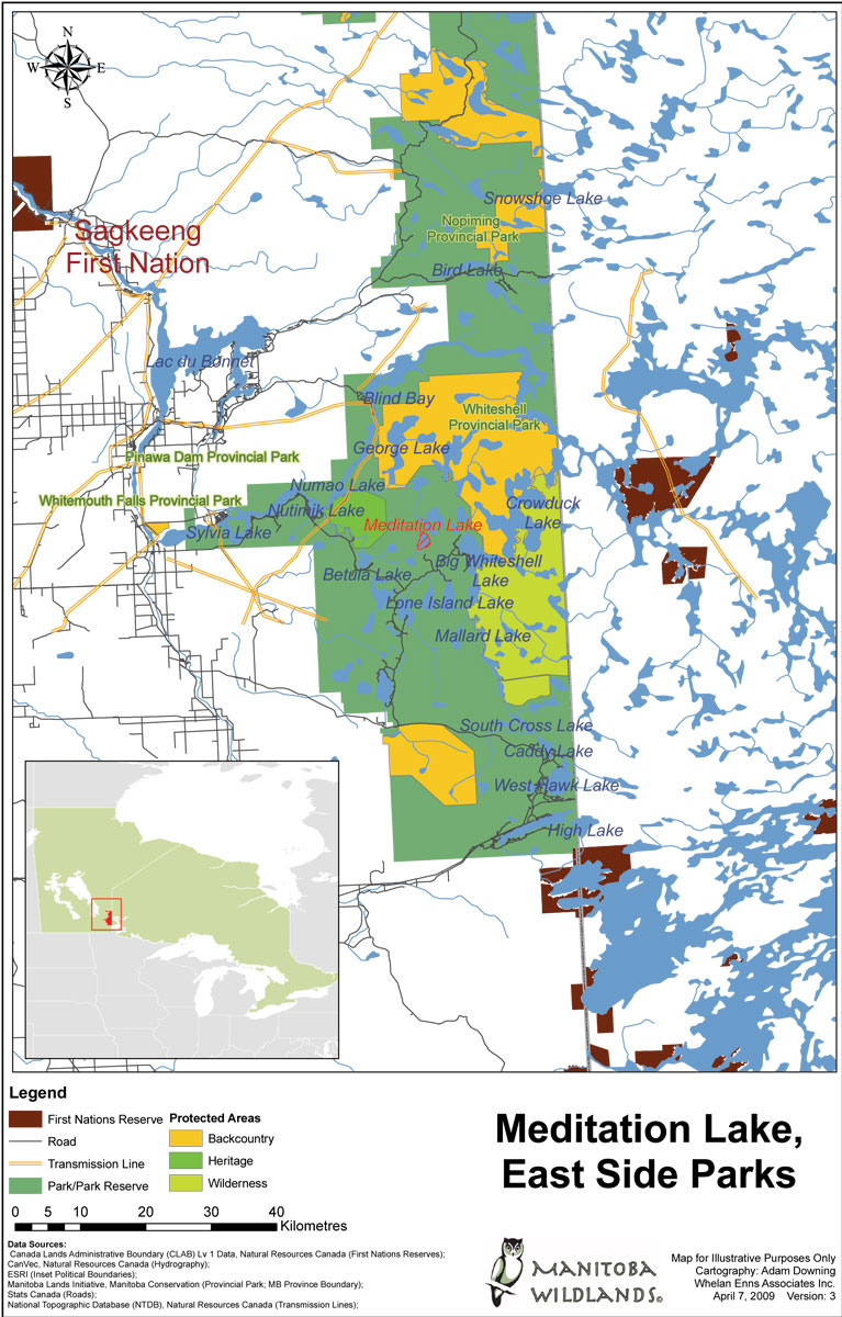 |
Title: Meditation Lake, East Side Parks Map Date: April 2009 Created by: Manitoba Wildlands |
|
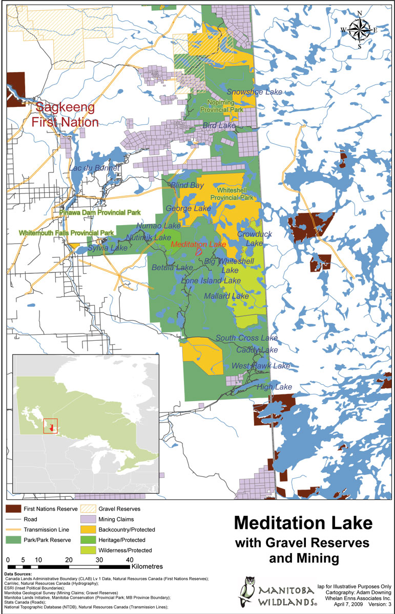 |
Title: Meditation Lake with Gravel Reserves and Mining Map Date: April 2009 Created by: Manitoba Wildlands |
|
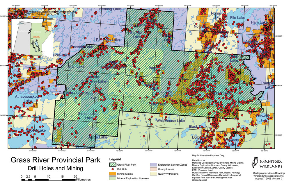 |
Title: Grass River Provincial Park - Drill Holes and Mining Map Date: August 2008 Created by: Manitoba Wildlands |
|
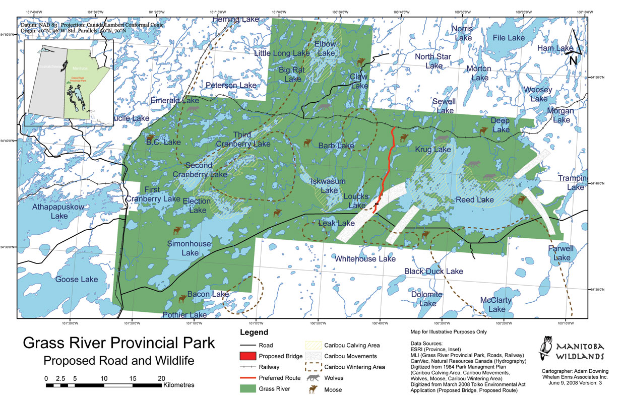 |
Title: Grass River Provincial Park - Proposed Road and Wildlife Map Date: June 2008 Created by: Manitoba Wildlands |
|
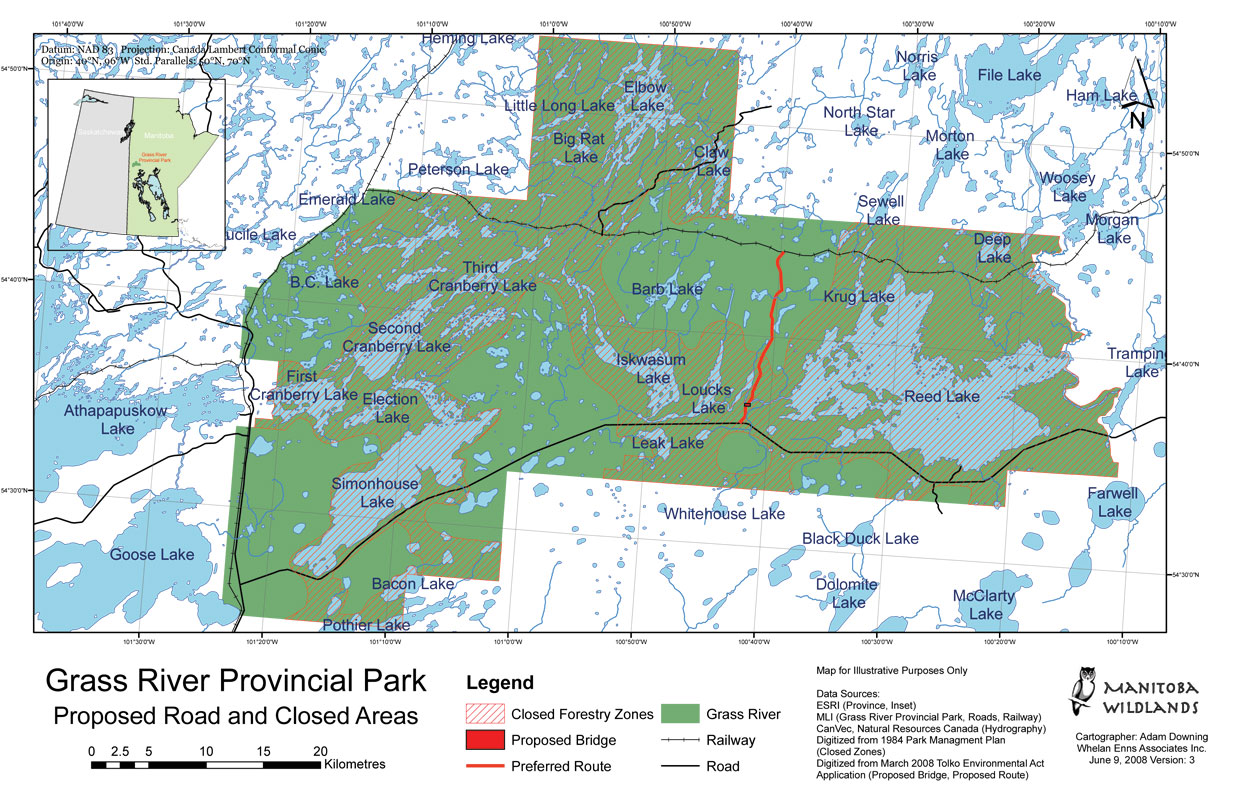 |
Title: Grass River Provincial Park - Proposed Road and Closed Areas Map Date: June 2008 Created by: Manitoba Wildlands |
|
 2002-2014