
Manitoba National Parks
| View an interactive map of Canada's National Parks Manitoba has two national parks: |
|
Riding Mountain |
|
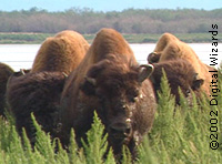
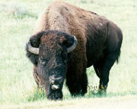 Bison |
Riding Mountain National Park was established in 1930. The Park covers an area of 3000 sq km and preserves an example of the Manitoba escarpment, which rises 500 meters from the Lowlands. The landscape is a patchwork of shallow lakes, hills, wet meadows, and mixed forests, characteristic of the prairie pothole countryside. Riding Mountain National Park is situated on the west side of the province and is an island of forested parkland in the midst of a sea of agricultural lands. |
| The centre of a Biosphere Reserve, Riding Mountain is one of the most stressed parks in Canada's national park system. View Riding Mountain National Park Management Plan Wapusk Wapusk National Park was established in 1996. It is located along the western shores of Hudson Bay, from the Churchill River, up to near the top of Manitoba and spans 11,475 km2 of tundra, muskeg, lakes and rivers. Wapusk is home to polar bears, woodland caribou, Arctic and red fox, Canada goose, lesser snow goose, swans, and many other species. Wapusk was established with the consent of the affected First Nations, who also sit on the park board.
 Visit the Parks Canada Wapusk National Park web page The Park Management Board for Wapusk is in the process of preparing a management plan for the national park. A management plan and a conservation plan are requirements for each national park under the National Parks Act. In summer 2004, the public was invited to comment on a draft management plan for Wapusk. Manitoba Wildlands provided comments on this draft management plan.  Download Manitoba Wildlands' comments on the draft management plan for Wapusk National Park Download Manitoba Wildlands' comments on the draft management plan for Wapusk National Park  (DOC)Download October 2007 Wapusk National Park Management Plan (PDF) (DOC)Download October 2007 Wapusk National Park Management Plan (PDF)Manitoba Lowlands - Future National Park A third national park is intended for Manitoba. Under discussion since the 1970s, and under study since 1992, the Manitoba Lowlands national park will be located in the lands above Lake Winnipeg and between Lake Winnipeg and Lake Manitoba. Two unconnected areas (dubbed "Long Point" and "Limestone") were identified by governments of Canada and Manitoba as candidates for the national park in 1996.
 Long Point connects Lake Winnipeg and Lake Winnipegosis. Limestone is at the top of Lake Winnipeg, and includes lands on the west side of Lake Winnipeg going towards Long Point. The 2004 potential boundaries include significant mixed boreal forest lands south of Long Point, towards the Chitek Lake Park Reserve. |
|
| To date there is no interim protection for these candidate sites. (Under Manitoba's provincial Parks Act, an interim protection mechanism can be used to safeguard lands while negotiations, planning, or consultations proceed.) The Mining Sector protected areas consultation, in support of Manitoba's protected areas commitments, approved roughly 500,000 ha for inclusion in the proposed National Park in 1998 and 1999. These lands were reviewed, and approved as 'Rank One' (supported for protection) by the Mining Sector. Most fall within the current (2004) geographic scope of the proposed national park. |
Rank One ASI's Proposed Lowlands National Park 2004 Map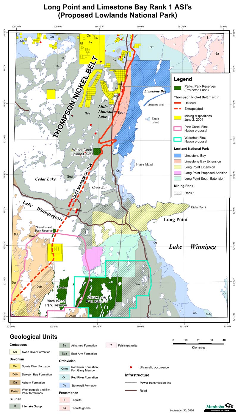 Larger Image |
| View the Chitek Lake Park Reserve and Lowlands National Park Map February 2005, Manitoba Wildlands. As of September 2004, Chitek Lake Park Reserve is the only protected area in or adjacent to the most recent potential boundaries for the proposed national park. This park reserve was established based on a 1998 nomination from the Skownan First Nation, and all lands were supported by the mining sector for protected status. (See map reflecting March 2004 boundaries. Also see map posted here which shows mining sector 'Rank One' lands.) |
Manitoba Lowlands National Park Proposed 2004 Map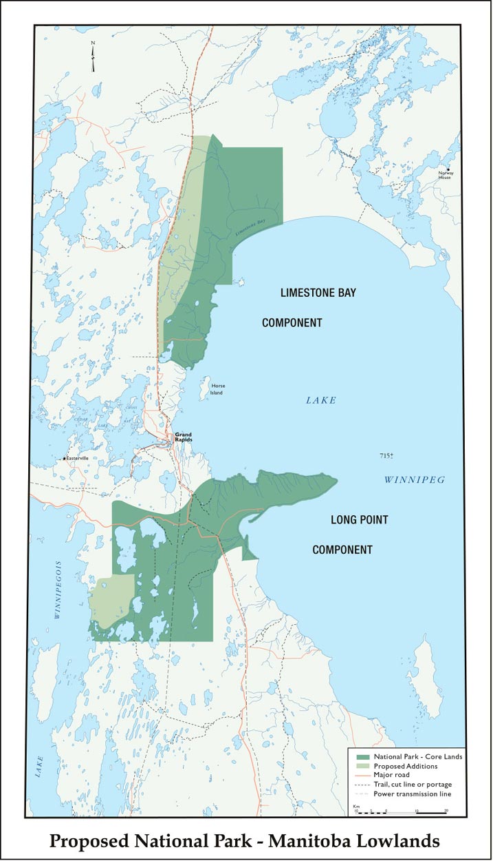 Larger Image |
Manitoba Lowlands National Park Proposal Map 2002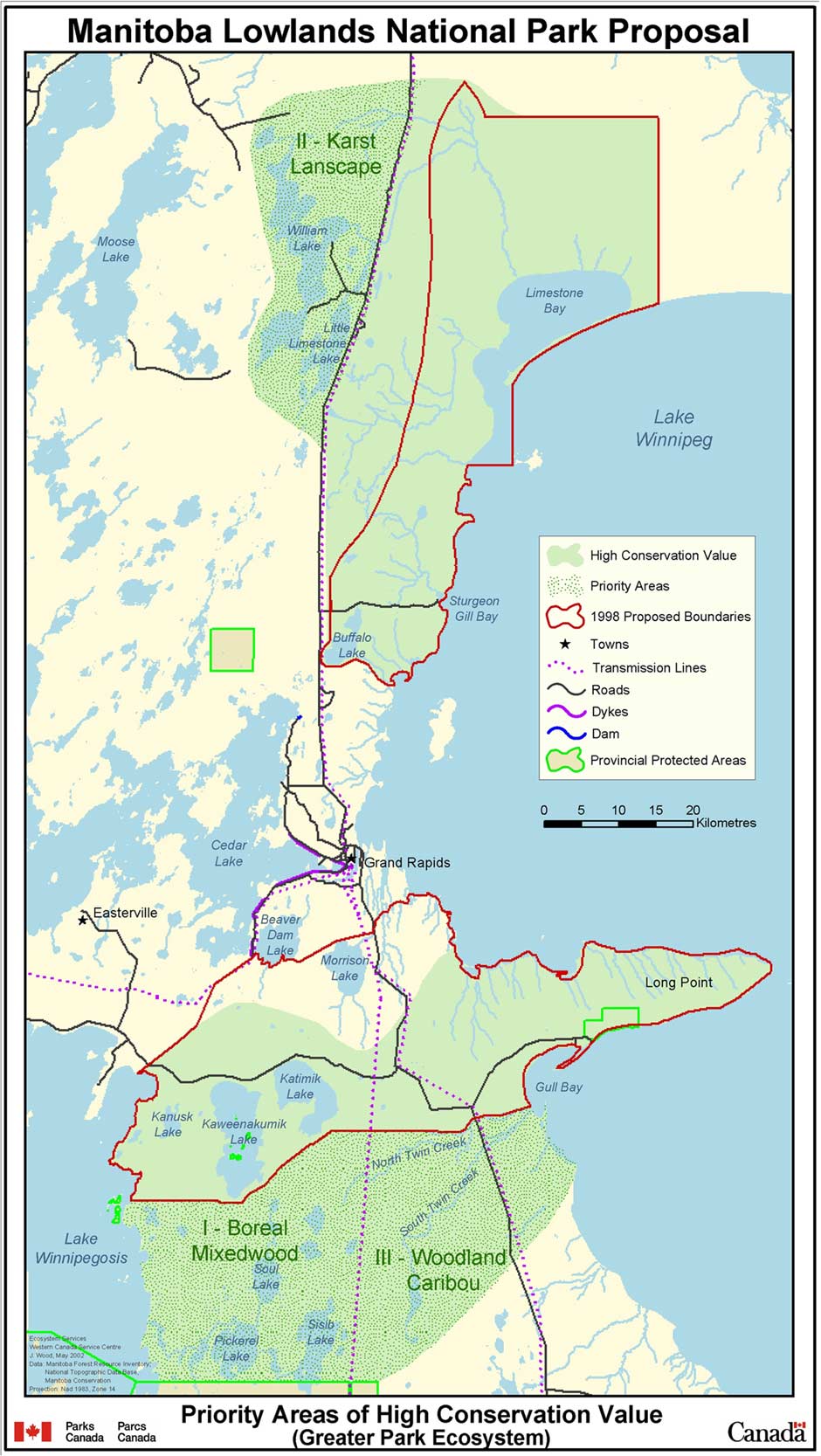 Larger Image |
Canada & Manitoba Lowlands MOUIn March 2004, Governments of Manitoba and Canada signed a memorandum of understanding (MOU) to work together to conclude consultations and negotiations for a Lowlands national park establishment agreement by May 2005 (see Manitoba Wildlands news item of March 23, 2004).Download MOU between Canada and Manitoba (DOC)No MOU has been signed with the affected First Nation communities respecting the establishment of the proposed Lowlands National Park. Parks Canada policy is explicit regarding the standards for consultations and respect for Aboriginal rights when establishing a new national park. Manitoba's First Nation protected areas MOU is also explicit about the required steps for decisions to establish new protected areas. In April 2004, Parks Canada released the Parks Canada Corporate Plan 2004 - 2009. The Plan includes references to the establishment of a new national park in Manitoba and states that "Parks Canada will work with the Government of Manitoba to achieve a park establishment agreement by March 2006, and will seek to involve Aboriginal and local communities fully in these negotiations from the outset". The March 2006 date for a park establishment agreement is contrary to the March 23, 2004 MOU between Canada and Manitoba that commits the two governments to complete the national park establishment agreement by May 2005. View April 1, 2004 Government of Canada press release View sections of the Parks Canada Corporate Plan 2004 - 2009 Download Parks Canada Corporate Plan 2004 - 2009 (PDF)Watch this page and our News page for continuing updates. View the March 2004 Canadian Nature Federation press release Manitoba Hydro & Lowlands National ParkThe document Hydropower Transmission in Manitoba - Manitoba Wildlands (January 2005) includes maps that show potential Manitoba Hydro transmission corridors through the Lowlands National Park region and suggested park components. Map and chart with transmission scenarios are provided below. Current Manitoba Hydro Operations/Lowlands National Park Map & Manitoba Hydro Transmission Options for Proposed Lowlands National Park Map 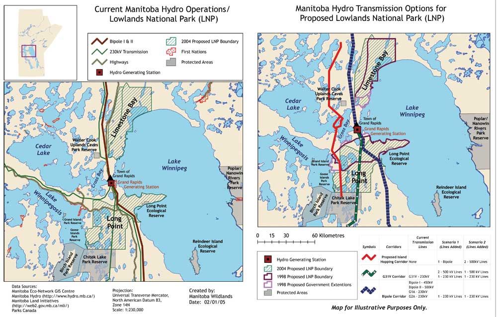 Larger Image |
||
Lowlands National Park TimelineCurrent as of October 2007View 1970 - 2004 2005 - Current: |
 |
|
|
Steps to a National Park
For information, click here
 2002-2014